The Nineteen Peaks of Chuanyan
The Nineteen Peaks of Chuanyan are Danxia cliffs of red conglomerate around Jingling, southwest Xinchang, Zhejiang, rising from the Chengtan River to 340 m. The Feilong Walkway, opened in 2016, runs 3.2 km with a glass section and a rope bridge; from Xiayanbei village you look down on the peaks.
The Nineteen Peaks of Chuanyan are a line of Danxia cliffs around Jingling Town in southwest Xinchang, Zhejiang: walls of red conglomerate rising from the east bank of the Chengtan River, the highest to about 340 meters above sea level. Chao News, in 2025, called them one of the largest groups of Danxia peaks in China, nicknamed the Zhangjiajie of eastern Zhejiang. There are two ways to see them: walk the Feilong Walkway along the cliffs inside the scenic area, or drive round to Xiayanbei village, to the east, and look down on them.
Our Places to Visit gives the peaks two paragraphs. This guide goes further: what the rock is, how the scenic area is laid out, how to walk the Feilong Walkway, and what we could and could not find out about tickets and transport.
The name and the place
“Nineteen Peaks” is a count. According to Chao News in 2025, each peak is named for its shape, among them Incense Burner Peak, Boat Mooring Peak and Saddle Peak; we found no reliable list of all nineteen. Chuanyan means, literally, “pierced rock”; Ctrip’s undated description of the sight mentions a natural cave on the side of Saddle Peak, the Chuanyan Cave, a chamber taller than a person. We found no reliable account of whether the name comes from that cave. In Jingling, people say the town has “thirteen peoples and nineteen peaks” (Chao News, 2025).
The river below is the Chengtan, which, according to Wikipedia, is the upper course of the Cao’e River and rises in eastern Pan’an County. A paper published in 2004 in the journal Tropical Geography by four authors from the Department of Earth Sciences at Zhejiang University and the Xinchang County tourism bureau (the 2004 paper, below) describes the Chengtan flowing past the west side of the peaks and, to the north, meeting the Hanfei River. The highest of the peaks, it says, is 340 meters above sea level and the floor of the Chengtan valley about 60 meters, a difference of some 280 meters. The paper also uses the place name Lao Chuanyan, “old pierced rock,” paired with Taitou Hill.
Red conglomerate: how the peaks were made
Danxia is a landscape of steep cliffs carved from red sedimentary rock, often summed up as flat tops, steep sides and gentle feet. The 2004 paper places Xinchang’s Danxia in a north–south belt along the west of the county, and says that the Nineteen Peaks, Qianzhang Valley and Taitou Hill, side by side, are where it is best developed and largest.
The rock dates from the Early Cretaceous. According to the paper, during the Yanshan orogeny the ground around Xinchang and Shengzhou began to subside in fault basins, and in a hot, humid climate it filled with the Guantou, Chaochuan and Fangyan formations, mostly red conglomerate, pebbly sandstone and sandstone, with some volcanic rock. Xinchang’s Danxia is mainly in the lower Fangyan Formation: conglomerate left by alluvial fans and braided rivers, 200 to 400 meters thick, with layers of sandstone and mudstone, the beds dipping gently east at 5° to 10°. Later the crust rose in several pulses, and running water, weathering and rockfalls cut the beds into the cliffs and peaks of today.
The paper puts the Nineteen Peaks at a “mature” stage of Danxia development, Taitou Hill still at a “youthful” one, and Qianzhang Valley, between the two, between “infancy” and “youth.” The authors estimate that the cliff faces of the Nineteen Peaks retreat by about 1.85 meters every ten thousand years; at that rate, in stable conditions, the cliffs and peaks would be gone in under a million years, worn down to rounded Danxia hills.
We found no support in the research literature for Chao News’s description of the peaks as one of the largest groups of Danxia in China. Xinchang also has a national geopark, the Xinchang Silicified Wood National Geopark (on Wikipedia’s list of national geoparks), but we found no reliable statement of whether the Nineteen Peaks lie inside it.
How the scenic area is laid out
According to Chao News in 2025, the scenic area has five parts: the Nineteen Peaks, the Feilong Walkway, Qianzhang Valley, Taitou Hill and Daotuoxue. In 2016, Zhou Canjun, deputy head of the Xinchang scenic and tourism administration, told The Paper that the area’s sights included the Nineteen Peaks, Qianzhang Valley and the Chongyang Palace, and that the Feilong Walkway is in Qianzhang Valley.
The point to remember is that the Nineteen Peaks and Qianzhang Valley are on different sides. In Zhou’s words at the time, they lie “on the two sides of the mountain, and you have to climb over the whole mountain.” The Paper quoted a visitor’s complaint: they parked at the Nineteen Peaks car park, climbed the peaks, only then learned that the glass walkway was in Qianzhang Valley, and on coming down found that the valley’s car park did not connect with the one they had left. Zhou’s advice was to park at the Qianzhang Valley car park if the glass walkway is what you came for. That was 2016; ask the scenic area about today’s entrances and shuttles before you go.
Ctrip’s description of the sight, which is undated, divides it into three adjoining parts linked by paths: the Nineteen Peaks, Qianzhang Valley and the Chongyang Palace. It gives two entrances, the main one at Yazhuang village near the peaks, where most visitors start, and another on the Qianzhang Valley side. By its account it is about 40 minutes’ walk from the foot of the hill up to General’s Rock; to the left of that is Saddle Peak, where a small pavilion on the summit looks down on the meeting of the two rivers. On the way back you can return the way you came or take a side path over a small wooden bridge into Qianzhang Valley. The valley is at the foot of the hills and mostly level, an hour or two’s walk, and the Chongyang Palace on its north side is both a film set and a Daoist temple. The description does not mention the Feilong Walkway.
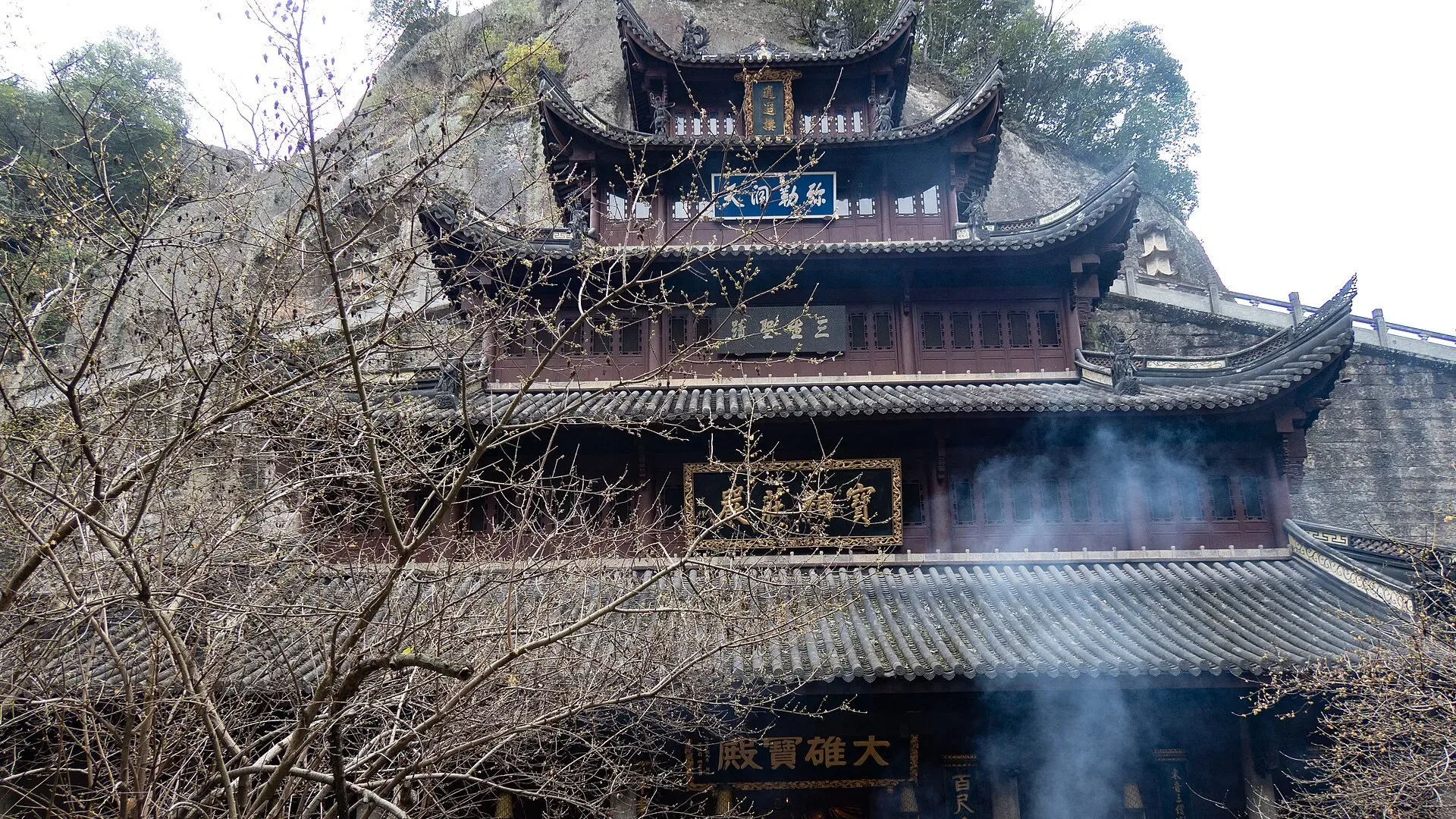
On December 28, 2009, the State Council issued its seventh list of national scenic areas, and Zhejiang’s Mount Tianmu Scenic Area was on it; according to Wikipedia, that area takes in the Great Buddha Temple, the Nineteen Peaks and Wozhou Lake among other sights. For the mountain itself, see Mount Tianmu. Hangzhou.com.cn described the Nineteen Peaks in 2021 as a national A-rated tourist site, and Ctrip’s listing tags it 4A (as of November 14, 2026), but we found no official notice giving the grade or the year it was awarded.
The Feilong Walkway
The Feilong Walkway opened in 2016. According to The Paper’s reports that year, it opened on trial over the National Day holiday in October and has three parts, a timber walkway, the Feilong sky bridge and a glass skywalk, 3,200 meters long in all, 1.6 meters wide and more than 200 meters above the ground. Its 108-meter glass skywalk was, the reports said, the longest in Zhejiang.
On the first day of the holiday, October 1, 15,000 people came, about twenty times the usual number, and 6,000 of them went onto the glass skywalk, far more than it was designed for, so the numbers going up had to be limited; over the whole National Day week it received 111,700 visits. From October 8 the walkway was closed for upgrading and load-tested by filling water tanks laid along it, up to 70 tonnes. It reopened free to Xinchang residents from December 15 to 31 and to everyone from 2017, with a maximum capacity of 8,000 people a day. Most visitors, a deputy director of the county tourism committee said at the time, came for the walkway.
As Chao News described it in 2025, you climb 999 steps cut into the cliff, and the whole route is one way, 3,200 meters long; at the top of the steps come a glass walkway about a hundred meters long at the edge of the drop and the Feilong rope bridge. The two accounts differ on the height: more than 200 meters above the ground in 2016, “as high as 150 meters” in 2025.
It takes stamina and a head for heights. We found no official word on age or health limits, or on whether the walkway closes in rain or high wind, so ask before you go.
Looking down from Xiayanbei
Going by the positions on OpenStreetMap, Xiayanbei village lies east of the Nineteen Peaks visitor center, little more than a kilometer away in a straight line but about 12 km by road (a map estimate).
Xinhuanet said in March 2026 that the Xiayanbei–Jinshanshang area has a fine view down over the Nineteen Peaks, is wrapped in cloud and mist on more than 200 days a year, and has dozens of guesthouses built for the view, as well as a cliff-edge café, a place to “fall asleep under the stars and wake to a sea of cloud.” We found nothing from weather services or local sources on the season or time of day when the cloud is most likely. It depends on the weather, and there is no guarantee.
On screen
According to Chao News in 2025, the television dramas Nirvana in Fire, The Legend of the Condor Heroes and Chinese Paladin were all filmed at the Nineteen Peaks. The last two have each been made more than once, and the article does not say which versions; we found no second reliable source on what was filmed here. Ctrip’s undated description names two others: it says Qianzhang Valley was a location for China Central Television’s The Smiling, Proud Wanderer and The Return of the Condor Heroes, among other martial-arts dramas, and that the valley has man-made sights such as the Shediao Cottage and the Wolong Villa. Xinhuanet mentioned in 2026 that Xinchang has also held a Nineteen Peaks motorcycle music festival.
Tickets, timing and when to go
We found no current prices or opening hours published by the scenic area itself or by the Xinchang county government, whose website we could not open. What follows is what Ctrip’s listing for the sight showed on November 14, 2026; check again before you go. Opening hours: 7:00 to 17:00 from April 10 to October 10, with last entry at 15:00, and 7:30 to 16:30 from October 11 to April 9, with last entry at 16:00. The Feilong Walkway keeps its own hours, 7:30 to 15:00 in summer and 8:00 to 14:30 in winter. Among other concessions, the listing gives free entry for children aged six or under, or no taller than 1.2 meters, and for people aged seventy and over; half price for children between 1.2 and 1.5 meters tall, people aged sixty to sixty-nine, minors and full-time students up to undergraduate level; and free entry for Shaoxing residents with an identity card, except during the Spring Festival and National Day weeks and the New Year, Qingming, May Day, Dragon Boat and Mid-Autumn holidays, when they pay as usual. The address on the page is Yimutan, Henglian village, Chengtan Subdistrict, Xinchang County, which is not Yazhuang, the village where the description puts the main entrance; the ticket enquiry number is 0575-86251638.
The page also carried a notice from the scenic area, marked as updated on October 28, 2026: the working group for Xinchang’s landscape tourism festival had decided that the Nineteen Peaks, the Great Buddha Temple and Mount Tianmu would waive main-gate tickets for visitors from anywhere in the country from October 28 to November 30, 2026. A line on the page added that entry in that period must be booked ahead, through a WeChat official account (公众号) or by other means. The page did not show the standard price at the time. It did not say whether the Feilong Walkway is charged separately during the free period. For earlier years, what we found is from 2016. According to The Paper, the notices that year came from the Xinchang County Nineteen Peaks Scenic Area Development Company; the peaks were among the sights in Shaoxing’s free-entry scheme for its own residents, free to them at weekends, and from December 31, 2016 that concession was suspended for the walkway at weekends and on holidays. For today’s prices and concessions, check the scenic area’s official channels or a booking platform.
We found no official advice on how long to allow; Ctrip’s undated description says a visit to the Nineteen Peaks takes half a day or a day. The walkway alone is 3.2 km and nearly a thousand steps, and in 2016 getting from the Nineteen Peaks side to Qianzhang Valley meant crossing the whole mountain. Going by those distances, we would allow at least half a day, and a full day if you add Xiayanbei. Holidays are crowded: during the National Day week of 2016, The Paper quoted a visitor who reported a four-hour queue for the glass walkway.
Getting there
The distances and times below are map estimates from OpenStreetMap road data, and will be longer on holidays:
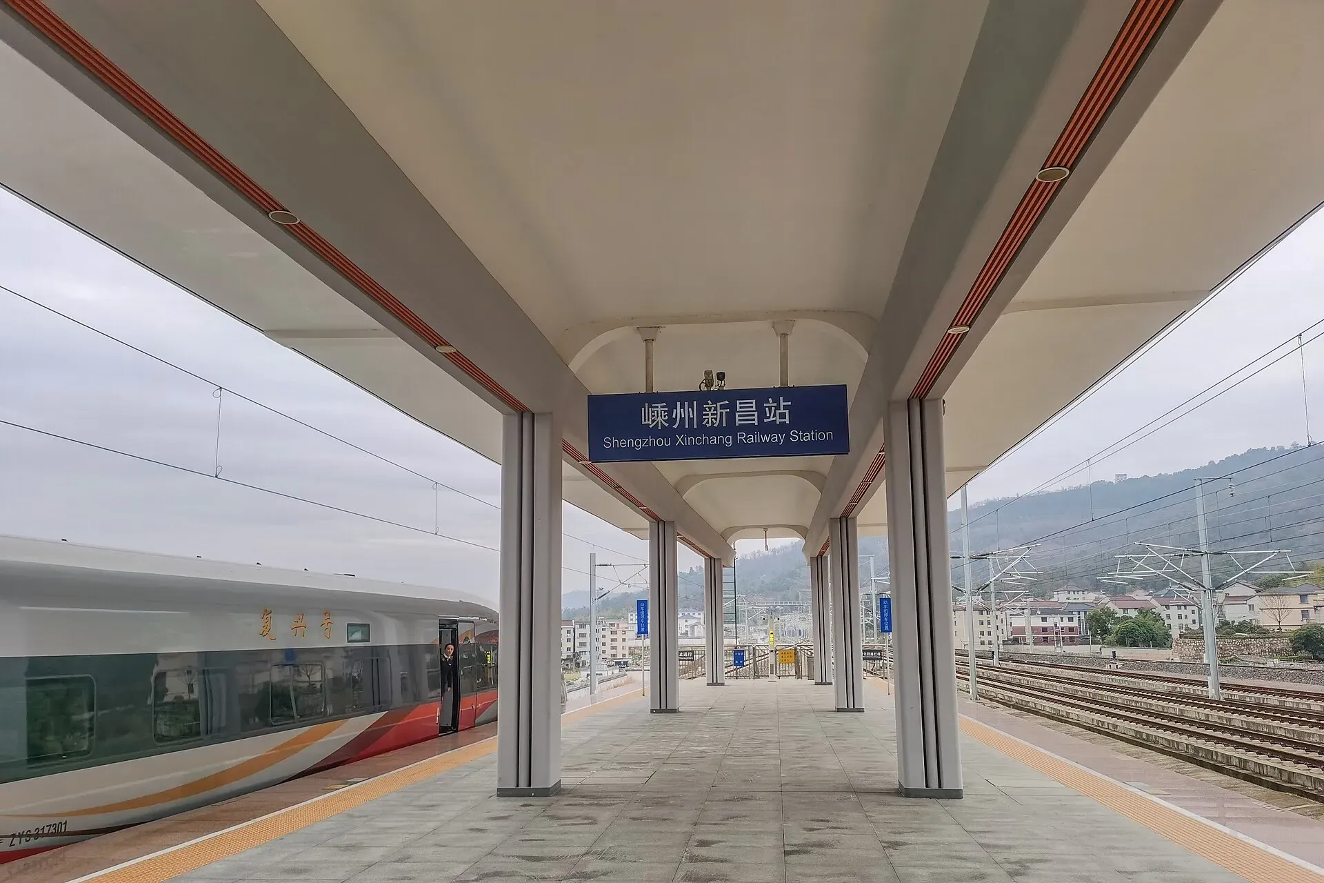
- Shengzhou-Xinchang station to the Nineteen Peaks visitor center: about 24 km, around half an hour
- Xinchang town to the visitor center: about 25 km, around half an hour
- The visitor center to Xiayanbei: about 12 km, under twenty minutes
- Shengzhou-Xinchang station to Xiayanbei: about 28 km, around half an hour
On the November 2026 timetable, the fastest high-speed trains from Hangzhou East reach Shengzhou-Xinchang in 37 minutes; schedules change, so check 12306 and see Getting to Xinchang. For a day trip from Hangzhou, see Day Trips from Hangzhou by High-Speed Train.
As for buses, Ctrip’s undated description says that rural buses also run on the side of the main entrance, at Yazhuang village, that from the stop you cross a bridge and walk 300 meters to the scenic area’s car park, and that no bus serves the entrance on the Qianzhang Valley side. We found no reliable, dated information on where those buses start or how often they run. According to The Paper, most of the crowds of the 2016 National Day holiday came by car. A taxi or a ride-hailing car from the station is the practical way; you may want to arrange the ride back with the driver.
If you drive, the Hangzhou–Shaoxing–Taizhou Expressway runs right under the peaks. According to Wikipedia, the Nineteen Peaks Tunnel (built as the Jingling Tunnel) is in Jingling Town, 5,510 meters long on the left bore and 5,583 meters on the right, and opened on December 22, 2020, with the section from the Jingling interchange to the Kuocang junction.
Nearby: Waipokeng, Jingling and the rest of Xinchang
In the hills of Jingling Town is the village of Waipokeng, about 40 minutes’ drive from the peaks according to Chao News in 2025; for the village, see Places to Visit. Xinhuanet in 2026 listed Jingling Old Street with the Nineteen Peaks and Meizhu Old Village among Xinchang’s places for a restful break; we found nothing more about the street.
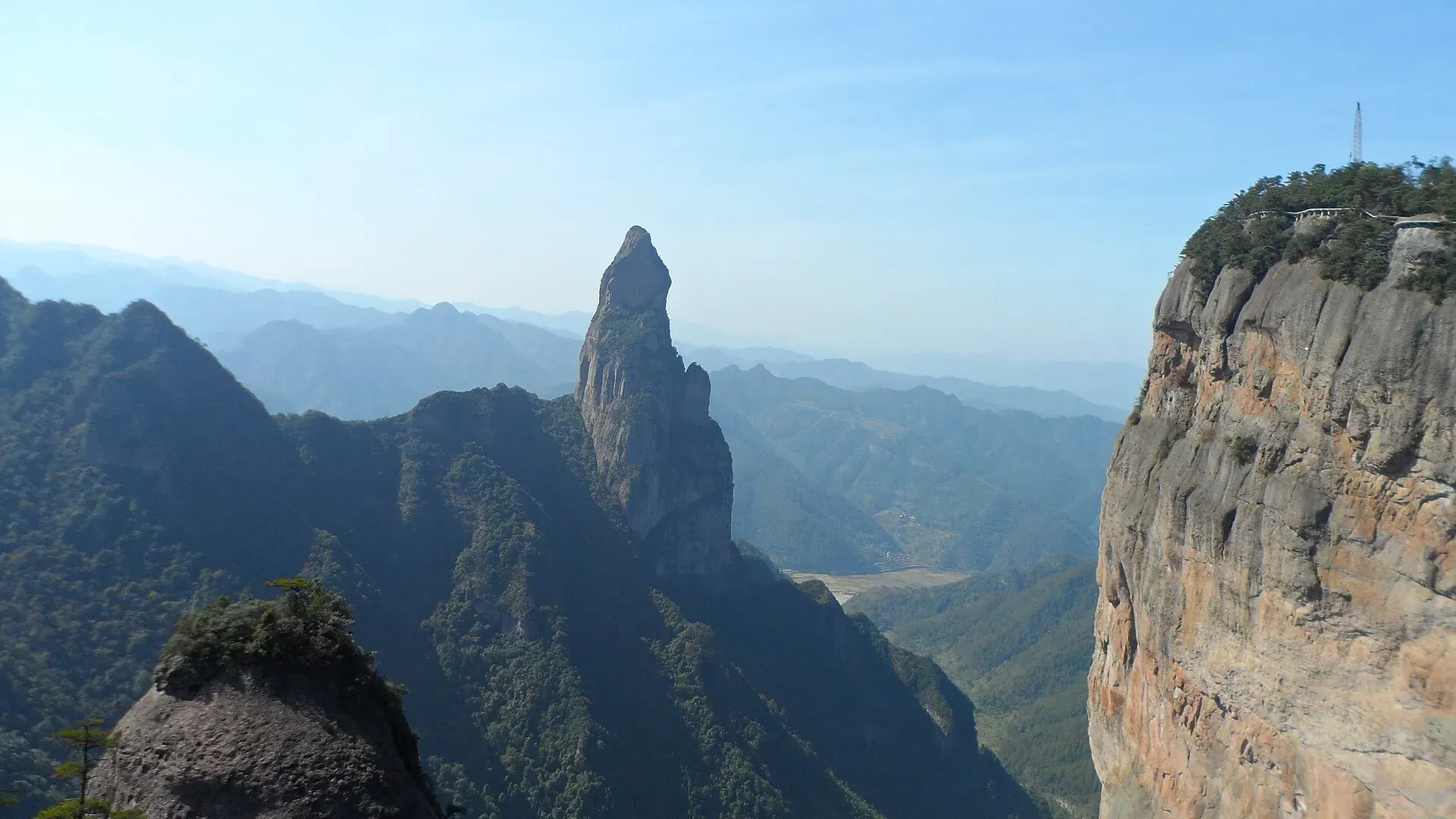
For the rest of Xinchang, the Great Buddha Temple, Mount Tianmu and Wozhou Lake, see Places to Visit. For cliff walkways and high bridges of another kind, Shenxianju in Xianju, to the south, is a mountain of volcanic rhyolite; see Shenxianju and the Ruyi Bridge.
Questions & answers
Where are the Nineteen Peaks of Chuanyan?
Around Jingling Town in southwest Xinchang County, Shaoxing, Zhejiang, on the east bank of the Chengtan River. The visitor center is about 24 km from Shengzhou-Xinchang station and about 25 km from Xinchang town, some half an hour by car from either (a map estimate).
What kind of landscape is it?
Danxia, a landscape of steep cliffs in red sedimentary rock. According to a paper in the journal Tropical Geography in 2004, Xinchang’s Danxia is mostly in red conglomerate of the lower Fangyan Formation, from the Early Cretaceous; the highest peak is 340 meters above sea level, about 280 meters above the floor of the Chengtan valley.
Is the Feilong Walkway hard going?
It takes stamina and a head for heights. According to Chao News in 2025, it is a one-way route 3,200 meters long with 999 steps up the cliff, then a glass walkway about a hundred meters long at the edge of the drop and a rope bridge. We found no official age or health limits.
How much are tickets, and when is it open?
When we looked at Ctrip’s listing on November 14, 2026, it gave the hours as 7:00 to 17:00 (last entry 15:00) from April 10 to October 10, and 7:30 to 16:30 (last entry 16:00) from October 11 to April 9. It also carried a notice from the scenic area that main-gate tickets were waived from October 28 to November 30, 2026, and another line on the page said entry in that period had to be booked ahead. The standard price was not shown at the time, and we found none published by the scenic area or the county government, so check again before you go.
Where can I see the peaks above a sea of cloud?
From the area around Xiayanbei village, to the east. Xinhuanet said in 2026 that the Xiayanbei–Jinshanshang area overlooks the peaks and is wrapped in cloud and mist on more than 200 days a year. It is about 12 km by road from the visitor center (a map estimate). Cloud depends on the weather, so there is no guarantee.
How do I get there without a car?
Take the high-speed train to Shengzhou-Xinchang station, then a taxi or a ride-hailing car for about 24 km. Ctrip’s undated description of the sight says rural buses also run on the side of the main entrance, at Yazhuang village, and that from the stop you cross a bridge and walk 300 meters to the car park; we found no route or timetable. For trains, see Getting to Xinchang.
Sources
- 英文为本站翻译。车程和距离,是按 OpenStreetMap 上十九峰游客服务中心、下岩贝村、嵊州新昌站和新昌县政府的位置,用 OSRM 路网估算的开车距离和时间;到嵊州新昌站、县城和下岩贝的距离,与本站《去哪儿走走》一致;高铁时刻与本站《从杭州出发的高铁一日游》一致(2026 年 11 月,中国铁路 12306)。外婆坑到十九峰的车程来自潮新闻。
- 不在贵州,在绍兴!这座大山里的小村竟藏着“最炫民族风” · 潮新闻(杨希林等),2025 年 1 月 5 日
- 美丽城市丨千年古城新昌赴一场诗与美好之约 · 新华网,2026 年 3 月 13 日
- 丹霞地貌的坡地形态演化——以浙江新昌丹霞地貌为例 · 高善坤、竺国强、董传万、余仲辉,《热带地理》2004 年第 24 卷第 2 期,131—135 页
- 浙最长空中玻璃栈道开放,景区客流增至20倍有人停车场过夜 · 澎湃新闻(葛熔金),2016 年 10 月 2 日
- 应对元旦春节游客井喷,浙江最长空中玻璃栈道要市民错峰让景 · 澎湃新闻(葛熔金),2016 年 12 月 26 日
- 国务院关于发布第七批国家级风景名胜区名单的通知(国函〔2009〕152号)· 中国政府网,2009 年 12 月 31 日
- 嵊州、新昌、天台通高铁啦!杭绍台铁路昨试运行 · 杭州网,2021 年 11 月 27 日
- 新昌十九峰(景区页:地址、开放时间、优待政策、景区公告和介绍)· 携程,2026 年 11 月 14 日查询;其中的介绍没有注明日期
- 新昌十九峰(手机版景区页:免大门票公告,限时免费和预约入园的说明)· 携程,2026 年 11 月 14 日查询
- 天姥山 · 维基百科
- 曹娥江 · 维基百科
- 十九峰隧道 · 维基百科
- 中华人民共和国国家地质公园列表 · 维基百科